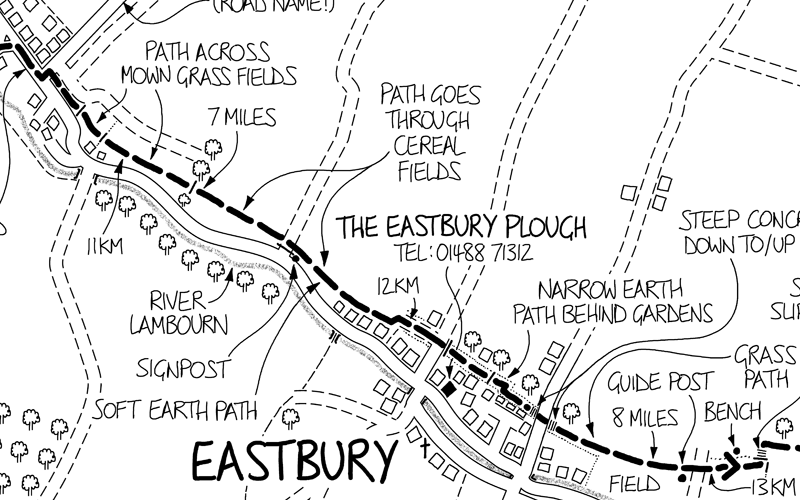
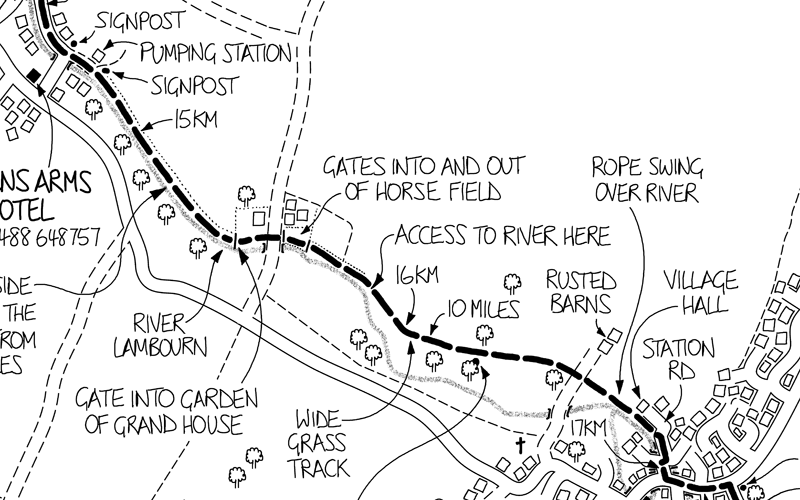
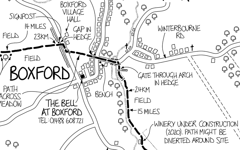
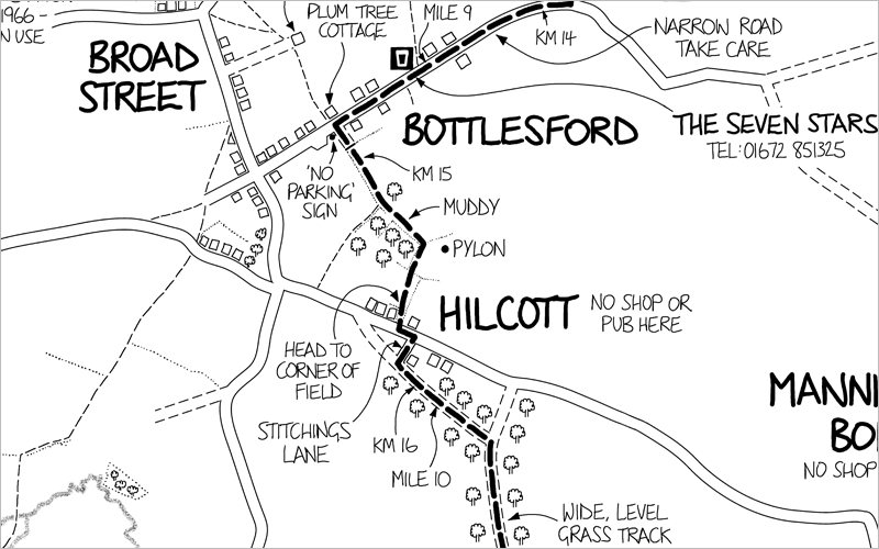
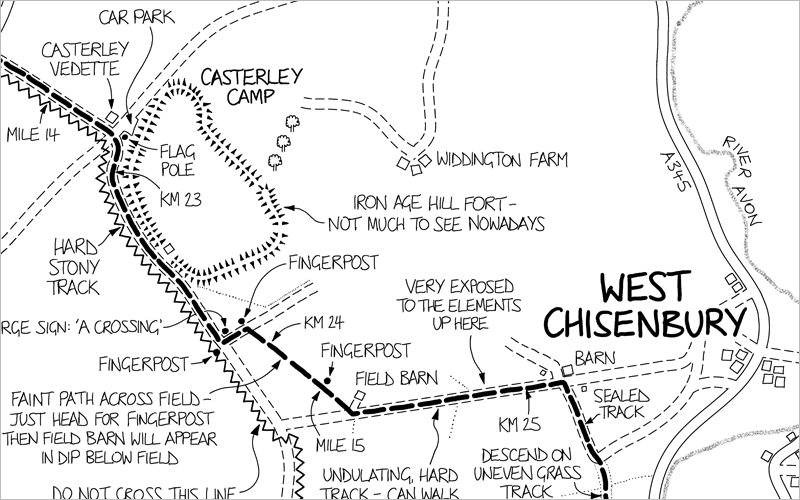
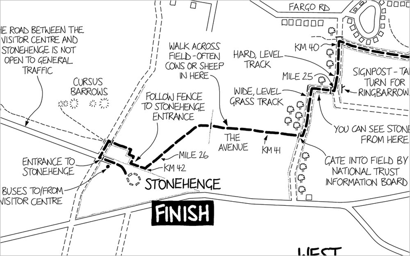
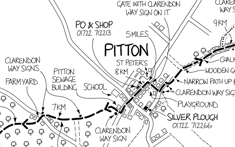
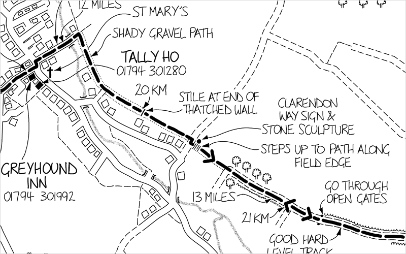
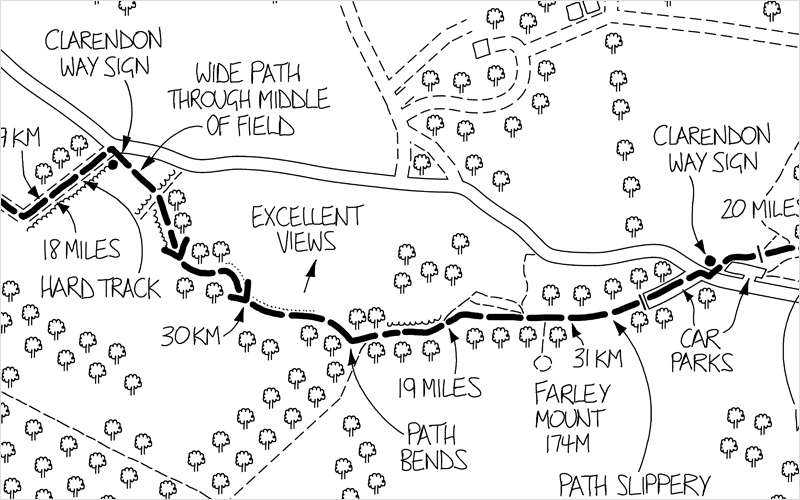
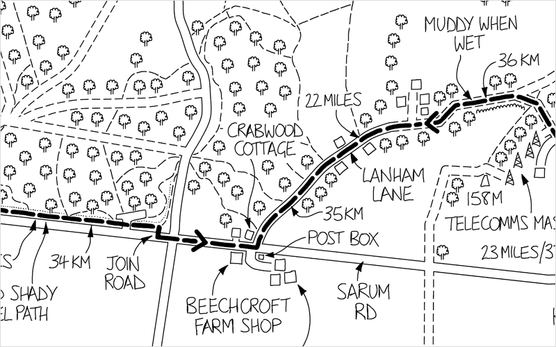
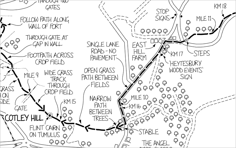
Route maps for walkers

Maps packed with all the information you need:

  Route-finding tips - you won't get lost

  Mile/km markers along the route

  Walking conditions underfoot

  Pub phone numbers

  Points of interest

Map details:

  594mm × 841mm

  Folded size 148mm x 210mm

  Packed in a clear plastic cover

  1:20,000 scale

  Only £6.99

Lambourn Valley Way Avebury to Stonehenge
Clarendon Way Imber Range Perimeter Path Avon Valley Path

Lambourn Valley Way

The 20-mile Lambourn Valley Way follows countryside paths and tracks between Whitehorse Hill, near Uffington, and Newbury.

Walk through open race-horse country to Lambourn, after which you follow the river to Newbury town centre.

ISBN 9780993505744

Avebury to Stonehenge

This 26-mile route follows countryside paths and tracks between the Neolithic sites of Avebury and Stonehenge.

From Avebury the route heads south to Adam's Grave before crossing the Vale of Pewsey and climbing onto Salisbury Plain.

ISBN 9780993505706

Clarendon Way

The 26-mile Clarendon Way follows countryside paths and tracks between Salisbury and Winchester cathedrals.

Pass through half a dozen villages en-route including Middle Winterslow, Broughton and King's Somborne, which all have pubs for refreshments.

ISBN 9780993505737

Imber Range Perimeter Path

The 30-mile Imber Range Perimeter Path follows countryside paths and tracks around the edge of the military training area.

Enjoy isolated walking in an unspoiled landscape that's dotted with military curiosities.

ISBN 9780993505713

Avon Valley Path

This 35-mile trail follows countryside paths and tracks along the course of the Avon Valley between Salisbury and Christchurch.

You'll also pass through the towns of Fordingbridge and Ringwood which make good stopping-off points.

ISBN 9780993505751